

North West Shelf Map
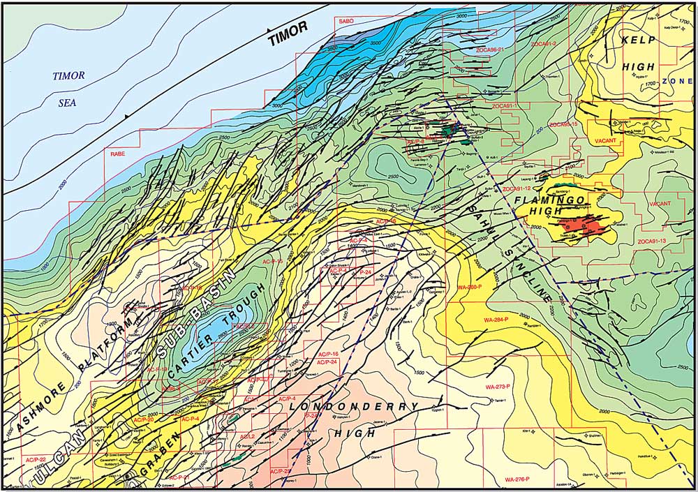
P&R’s regional North West Shelf map is a TWT-structure map at the Base Cretaceous level, extending over the entire North West Shelf from Cape Range in the southwest to Darwin in the northeast. Prepared by integrating over 200 open-file and published maps, with a 100 millisecond contour interval, the map offers explorers a regional perspective on this important hydrocarbon province.
The map has been coloured to show the various basins, sub-basins and structural provinces, all of which are labeled. All permits, fields and wells are shown (to date of last update) and labeled.
The map is available under licence as both prints and digital files, both Mapinfo and ArcGis. The digital file allows the licensee to select small or large areas to incorporate into internal reports and presentations, and to insert proprietary data into the map.
Prints are available as two east/west- panels (the more popular format) or as a single NW/SE-oriented sheet. A 1/500,000-scale print of the Timor Sea area is also available and is a useful reference map for explorers working permits within this region. PDFs of these maps are provided complimentary with the digital file.
The licence fee for the digital file is $5000, and comes with a print of the map and printable post-script files.