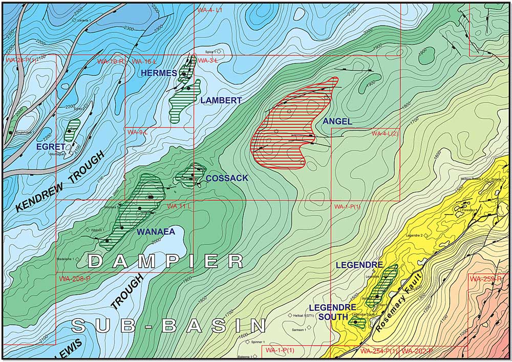


Carnarvon Basin Time-Structure Map
P&R’s Carnarvon Basin Time-structure Map presents detailed 20 millisecond TWT contours at the base Regional Seal horizons, being a merging of maps at the Base Cretaceous and Base Muderong levels. Prepared by integrating over 100 open-file, proprietary and published maps, the map offers both a regional perspective and local detail.
The map has been coloured to highlight the basins, sub-basins and structural sub-divisions, all of which are labeled. On closer inspection, the 20 millisecond contours show local details of closures and faults trends. All fields, wells and pipelines are shown (to date of last update).
The map is available under licence as a Microstation file and also as a two-panel (east/west-orientation) at 1/250,000 scale.
The licence fee for the digital file is $8000, and comes with a 1/250,000 scale print of the map and printable post-script files at various scales.
Contact Peter Purcell for further details regarding updates and licence costs.