‘Basalt rivers’ of the Ogaden
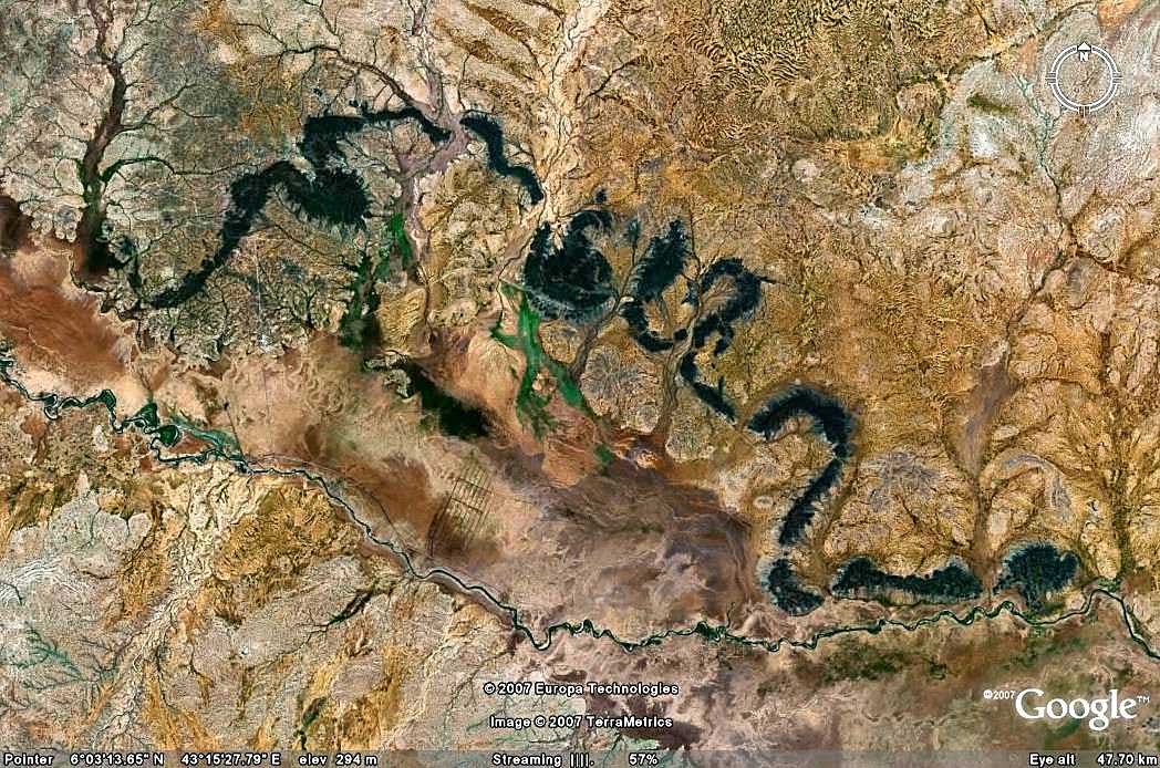
Long (> 100 km) basaltic flows in paleo-river channels, now exhumed as meandering basalt hills, are prominent features of Ogaden landscape. These hills are readily visible on Google Earth.
The most spectacular complex is the Gode flow, which can be traced for more than 200 km and appears to have flowed into the large meandering channel of the paleo-Wabe Shebele. The paleo-Shebele was a much large river than the present river, and the scale of the meanders has implications for the climate of the Ogaden at that time. Two samples from this flow yielded a 7.5±0.4 Ma 4Ar40/Ar39 age, which significantly postdates the main Ethiopian flood basalt events and other Ogaden flows.
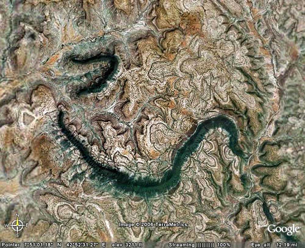
The meandering basaltic outcrops along the Juba River to the south in Somalia are very similar geomorphologically to the Gode flow outcrops but appear to be of Oligocene age, based on their early dating by Italian geologists and their apparent continuity with the large Dolo volcanic complex on the Somalia/Ethiopia border, dated at c 27 Ma. The Dolo volcanic centre also appears connected to a massive meandering flow complex extending east to the Somalia coast near Mogadishu.
In the central western Ogaden, an elegant chain of meandering hills extends south for 120 km from the Daga Medo flow. No recent age dating has been done but oil exploration company Maxus obtained 27.4±1.4 Ma using the K-Ar method in 1993. It is clear that at least two different flow systems are represented in the meandering Ogaden hills of today.
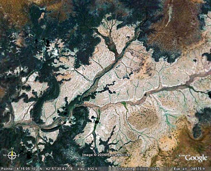
These flows are well defined by aeromagnetic data which have revealed multiple canyon-filling flows in the eastern Ogaden and shown that seemingly isolated outcrops are actually part of extensive flows, much of which are buried under the Ogaden sands.
View Interactive Map of Images
Image Gallery